🚍 GTA GO Train Coverage Network Analysis
📌 Objectives
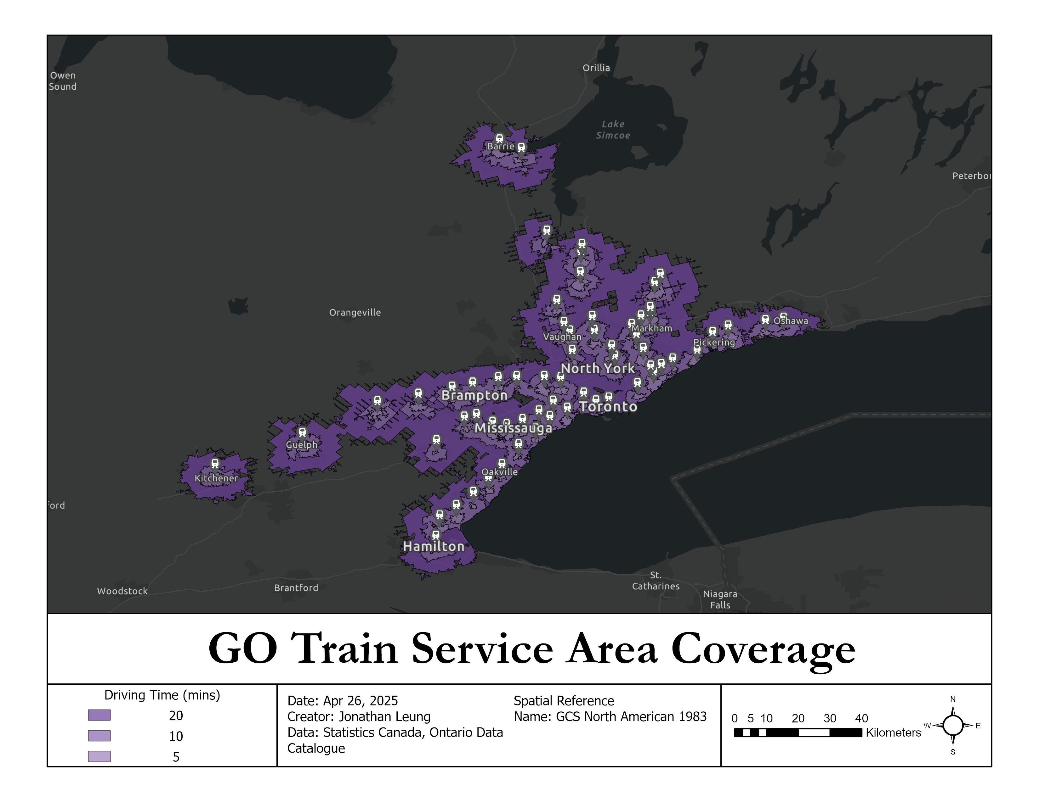
- Conducted service area analysis on the GO Train railway system to assess its service coverage across the Greater Toronto Area
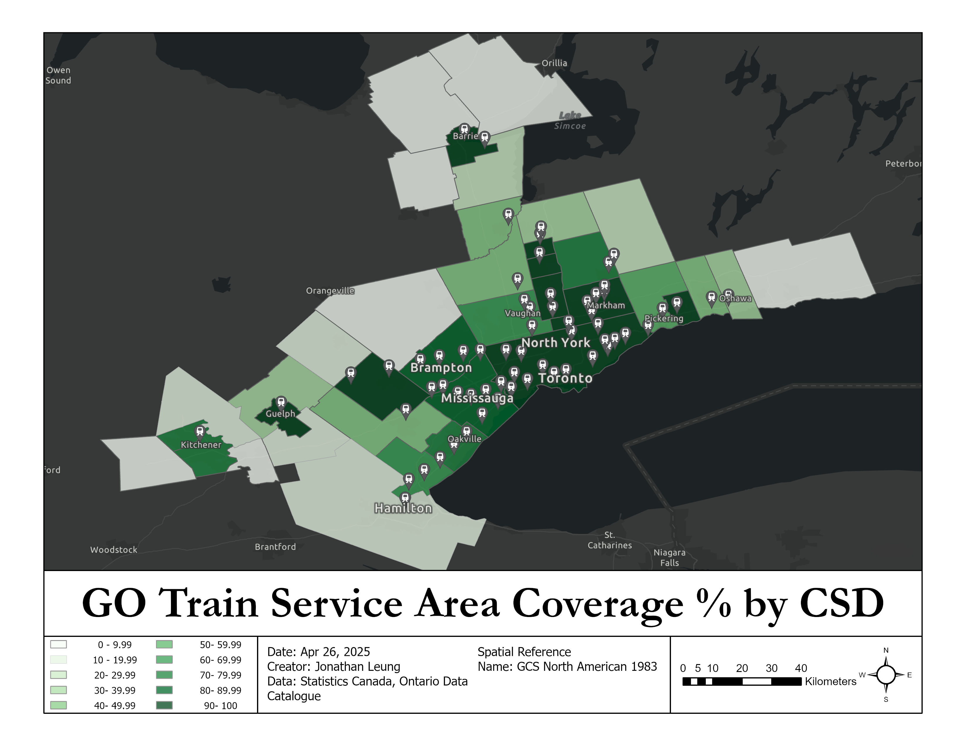
- Analyzed percentage transit coverage within each GTA Census Subdivision by driving time
- Support transportation planning, such as future stations, with data-driven results
- Identify transit gaps by highlighting municipalities with little coverage within the service area
🧰 Tools
- ArcGIS Pro
ℹ️ Data
- Ministry of Transportation. "GO Train stations"[csv].Scale Not Given. "Ontario Data Catalogue". April 25, 2024. https://data.ontario.ca/dataset/go-train-stations
- Statistics Canada. "2016 Census Program - Age and Sex Highlight Tables"[shp,csv].
📊 Workflow
A. 🛜 Service Area Analysis
- Import the GO Train Station point layer as facilities into the Service Area Analysis tool
- Generate Service Area polygons on 5, 10, and 20-minute driving time
B. 🔧 Configuring Census Subdivision Layer
- Run Select By Location CSDs in the CSD shapefile that intersect with the service area layer
- Join Census Data with CSD shapefiles using Spatial Join
- Use field calculator to calculate the total area of each CSD polygon
C. 💡 Creating an overlapped feature class
- Run Intersect with the CSD layer and the service area layer to produce a new feature class of polygons containing overlapping areas
- Calculate the total area of each polygon with field calculator
- Calculate the sum of polygons that share the same CSDUID
D. 🧮 Computing the transit coverage% of each CSD
- Join the overlapped feature class to the original CSD shapefile using CSDUID (identifier)
- Calculate % of each CSD's area covered by the service area
🗺️ Output
✍️ Author
Jonathan Leung — University of Waterloo, Geomatics with Co-op